Geography
Why Is Odisha Having Its Wettest Monsoon Since 2000? The Bay of Bengal Deep Depression Explained
By Shivam Singh, Founder & Mentor, Minimalist IAS
· Updated · 3 min read

Odisha is heading for its wettest monsoon since 2000 because a deep depression over the Bay of Bengal — the strongest of 11 weather systems this season — delivered the single highest spell of rain. By 25 September the State had logged 1,453.1 mm, 29% above normal, while the same system flooded coastal Andhra Pradesh and took its flood death toll to nine.
In the news (26 September 2026): A deep depression over the Bay of Bengal has pushed Odisha towards its wettest monsoon since 2000 and triggered flooding in coastal Andhra Pradesh, taking the Andhra Pradesh flood death toll to nine.
Key facts at a glance
Record rainfall: Odisha logged 1,453.1 mm of rain between 1 June and 25 September — 29% above normal, with five days of the season still left.
Cause: 11 weather systems, including low-pressure areas and depressions over the Bay, drove this year’s rain; the current deep depression triggered the single highest spell.
Andhra Pradesh impact: Heavy inflows swelled the Nagavali, Vamsadhara and Bahuda rivers in Srikakulam; four fresh deaths pushed the State’s flood toll to nine.
Response: North Coastal Andhra Pradesh has shifted to restoration mode, and the Odisha and Andhra Pradesh administrations are coordinating on upstream flow monitoring.
Formation zone: Most such systems form in the monsoon trough/ITCZ over the head Bay of Bengal in September–October.
How does IMD classify low-pressure systems?
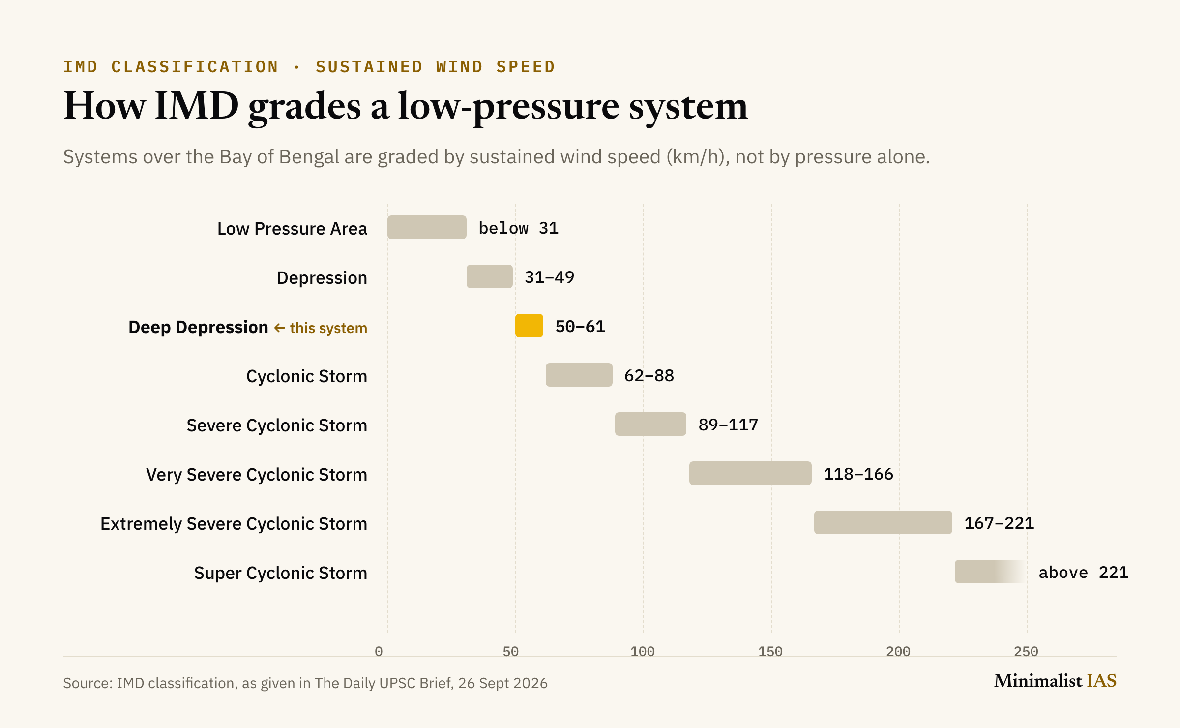
The India Meteorological Department grades low-pressure systems over the Bay of Bengal by sustained wind speed, from a low-pressure area up to a super cyclonic storm:
Low Pressure Area: below 31 km/h
Depression: 31–49 km/h
Deep Depression: 50–61 km/h
Cyclonic Storm: 62–88 km/h
Severe Cyclonic Storm: 89–117 km/h
Very Severe Cyclonic Storm: 118–166 km/h
Extremely Severe Cyclonic Storm: 167–221 km/h
Super Cyclonic Storm: above 221 km/h
Why it matters for UPSC
GS Paper 1 (Geography): cite this as a live example of geophysical phenomena — Bay of Bengal cyclogenesis and the ITCZ shift. GS Paper 3 (Disaster Management): link it to inter-State disaster coordination and NDMA’s early-warning protocols.
Practice: Prelims MCQ
With reference to low-pressure systems over the Bay of Bengal, consider the following statements:
A ‘Deep Depression’ has a sustained wind speed higher than a ‘Depression’ but lower than a ‘Cyclonic Storm’.
Such systems are classified by the India Meteorological Department solely on the basis of central atmospheric pressure, not wind speed.
Which of the statements given above is/are correct? (a) 1 only (b) 2 only (c) Both 1 and 2 (d) Neither 1 nor 2
Answer: (a) 1 only. IMD classifies Bay of Bengal low-pressure systems primarily by sustained wind speed (depression, deep depression, cyclonic storm, and so on), not by pressure alone.
Terms to know
IMD: India Meteorological Department
ITCZ: Inter-Tropical Convergence Zone
NDMA: National Disaster Management Authority
Frequently asked questions
What is a deep depression?
A deep depression is a low-pressure system with sustained wind speeds of 50–61 km/h, as classified by the India Meteorological Department. It is stronger than a depression (31–49 km/h) but weaker than a cyclonic storm (62–88 km/h).
How much rain has Odisha received in the 2026 monsoon?
Odisha logged 1,453.1 mm of rain between 1 June and 25 September 2026, 29% above normal, putting the State on course for its wettest monsoon since 2000.
Which rivers flooded in Andhra Pradesh?
Heavy inflows from the deep depression swelled the Nagavali, Vamsadhara and Bahuda rivers in Srikakulam district, and the Andhra Pradesh flood death toll rose to nine.
Does IMD classify cyclones by wind speed or by pressure?
By sustained wind speed. The India Meteorological Department grades low-pressure systems over the Bay of Bengal from a low-pressure area up to a super cyclonic storm according to their sustained wind speed, not central pressure alone.
Key takeaways
A single deep depression — one of 11 systems this season — produced Odisha’s heaviest spell and a 29% rainfall surplus.
IMD’s wind-speed scale runs from a low-pressure area (below 31 km/h) to a super cyclonic storm (above 221 km/h).
Use it in GS1 for cyclogenesis and in GS3 for inter-State disaster coordination.
Related reading
From The Daily UPSC Brief, 26 September 2026 — by Shivam Singh.
Spotted an error or something outdated? Tell us — we correct it.
About the author
Shivam Singh
Founder & Mentor, Minimalist IAS
Shivam has been through every stage of the exam himself — Prelims, repeated Mains attempts across UPSC and state civil services, and the interview board. For 7 years he has mentored aspirants one-to-one, helping 100+ clear various stages of the exam, including final selections.
More about Shivam →